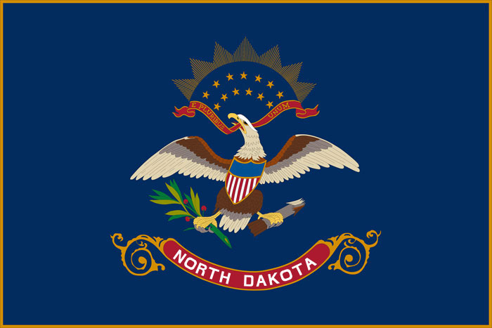
Improving Lives Through Quality Maps and Data ...
The NDDOT Roadway Data Program collects, maintains and communicates quality data through data governance, data management and GIS products. This webpage includes a variety of helpful map-related resources produced by the team.
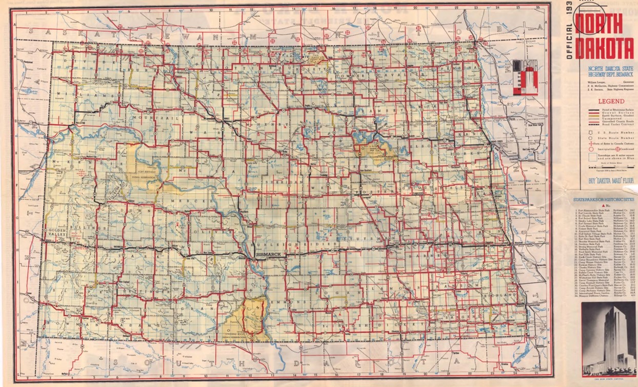
History of the North Dakota Official Highway Map
In 2024, the North Dakota Highway Map is celebrating 100 years! As one of the most visible maps, it is rich in history and documents the changes in our highway system. The map is a representation of our state and allows visitors and residents to find their destinations easily while noting points of interest throughout the state.
The Official Highway Map is a joint effort between the NDDOT and the Department of Commerce Tourism Division, with the map side produced by NDDOT and the ND points of interest side produced by the Tourism Division.
Special Edition 100th Anniversary Blog
2024 marks 100 years of the first official North Dakota State Highway map. In honor of this exciting marker in time, members of the mapping team created a blog series.
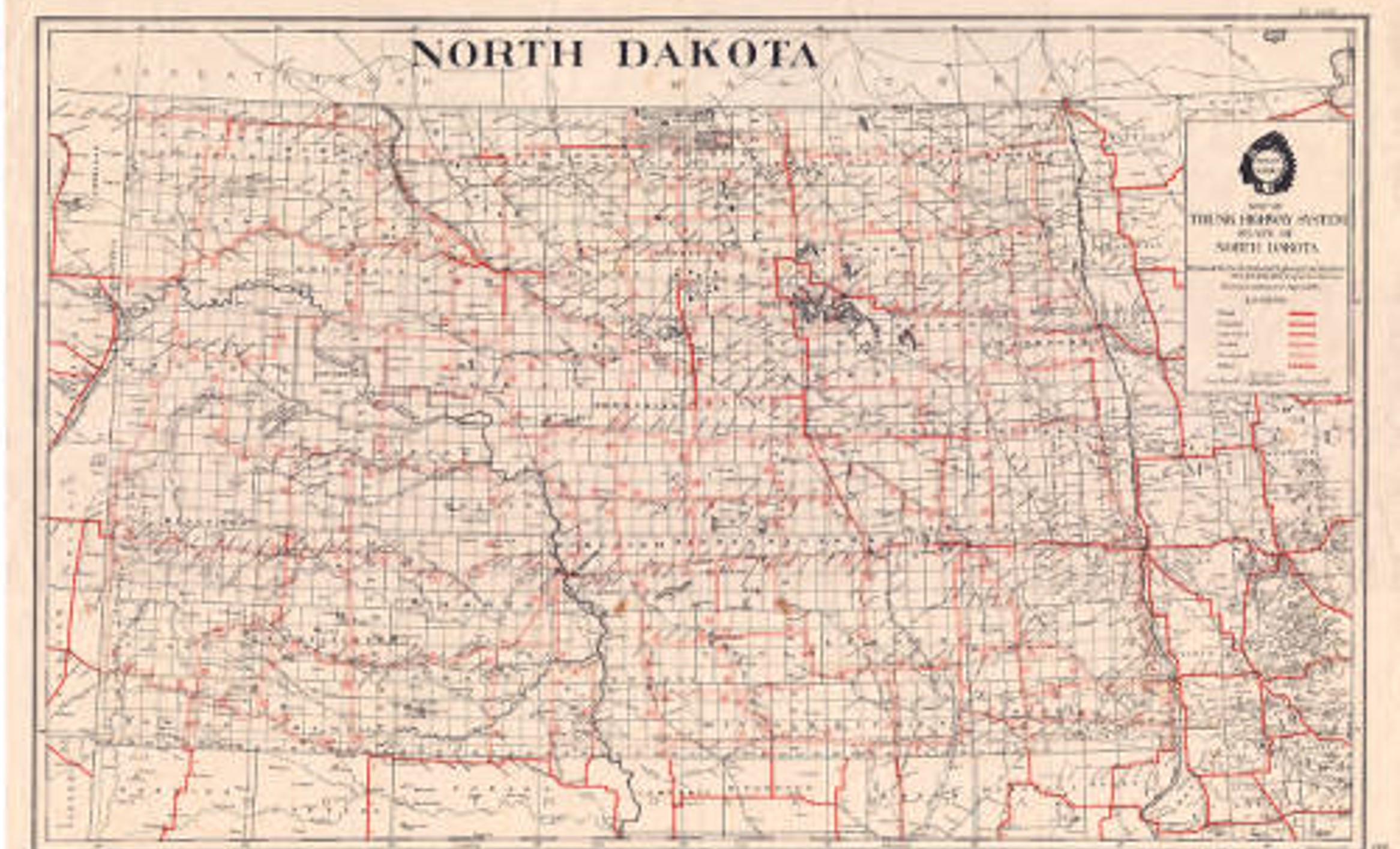
1924: Trunk Highway System of ND
The first map was one-sided and printed in black with one additional color (red) for roads.
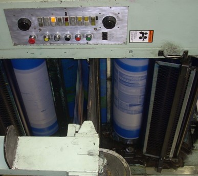
Map Printing Process
In the 1950s, the map was printed externally. The price of each map hovered around 10 cents until 2003. The price steadily increased until 2021, when each map cost 29 cents to produce. NDDOT printed approximately one million maps per printing cycle until 2017. Currently, a smaller number of maps are printed to allow flexibility in the update and print cycle.
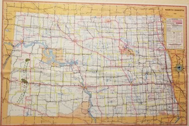
1924 - 1963
NDDOT has produced a State Highway Map in one form or another since 1924. It's believed the State Highway Map was not produced in 1943, 1944 and 1945, but it has been printed as scheduled in all other years. The map has undergone many changes: from one-sided to two-sided and from black and white to multi-colored.
1964 - 1988
In 1964, NDDOT began using the American Association of State Highway and Transportation Officials' (AASHTO) symbols to standardize the map.
In 1981, major cities were added to the bottom of the map. These insets were the first items on the map to be produced in-house. Prior to this, NDDOT sent edits to the printer, who would then modify the previous map and print the update. In-house drafting of the base map began several years later.
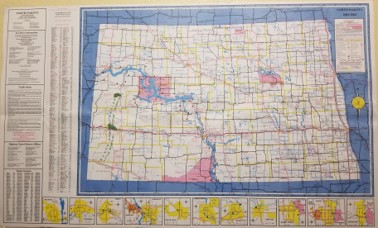
1989 - 2005
Due to complications with contracting printers, NDDOT decided to produce the entire map within the department.
In 1989, NDDOT rebuilt the base map in-house and standardized the text and line work. Since map consistency and sight recognition are important factors in creating a usable map, the map became more user friendly as a result. The standards developed at this time are still largely in use today.
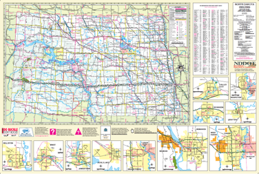
2005 - Present: The Digital Era
In 2005, NDDOT implemented ESRI ArcMap, bringing the ND State Highway Map into the digital age.
A committee consisting of approximately 20 state, city and private groups was created to review the map. One significant decision was to increase the size of the map, which allows for more travel information to be printed on both sides of the map.
Statewide Maps
This is a stripped-down version of the current printed map, presented as a PDF. The NDDOT has produced a State Highway Map in one form or another since 1925.
North Dakota Route and Mileage Map
A two-sided map that displays reference points at all highway intersections. As a bonus, it also shows District Boundaries.
North Dakota National Highway System Map
The National Highway System consists of roadways important to the nation's economy, defense and mobility. These are the roads that participate in the state.
This map shows the eight districts in the state and their addresses.
Highway Performance Classification System
The state highway classification map displays roads that are federally classified as Interstate, Interregional, State Corridor, District Corridor or District Collector. Detailed information regarding each classification is available on the webpage below the map.
The ND rail map displays the state railroad network. Active rail lines are displayed by ownership. Rail routes abandoned between 1980 and 2015 are also shown on the map.
This is a base map of the state of North Dakota. County boundaries, county seats, incorporated cities and the state capitol are shown on the map, along with all interstate, US and state highways.
The Roadway Information team works in conjunction with the NDDOT Maintenance division to help publish Truck Routing Maps. These maps are available to the public and include information such as weight and length limits for Over the Road (OTR) drivers.